Weather Explained: How Forecasts Work and Why They Matter
 David Mccullough
 Every morning, millions of people check their phones for one simple piece of information: will it rain today? Weather influences virtually every decision we make, from choosing an outfit to planning a wedding six months out. It determines whether flights take off on time, crops survive the season, and outdoor events proceed as scheduled. Despite its everyday presence in our lives, weather remains one of nature's most complex and unpredictable phenomena.
Understanding weather means grasping the intricate dance of atmospheric conditions that constantly shift above our heads. Temperature, humidity, wind speed, air pressure, and precipitation all interact in ways that scientists have studied for centuries yet continue to surprise us. A sunny morning can turn into an afternoon downpour. A mild winter day might precede a sudden snowstorm. The atmosphere keeps meteorologists humble.
The Science Behind Weather Patterns
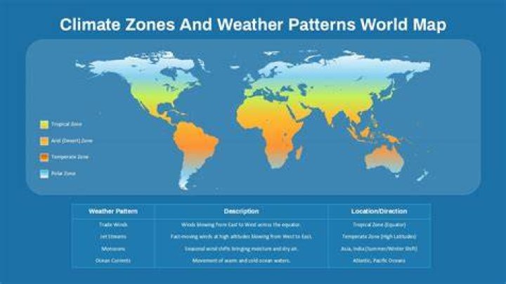
Weather originates from the sun's uneven heating of Earth's surface. The equator receives more direct sunlight than the poles, creating temperature differences that drive air circulation. Warm air rises, cool air sinks, and this perpetual motion generates wind patterns that move moisture and heat around the planet. Oceans absorb and release tremendous amounts of thermal energy, moderating coastal climates while fueling massive storm systems.
Air masses form when atmospheric conditions remain stable over a region for extended periods. A cold, dry air mass might develop over northern Canada during winter. A warm, moist mass could build over the Gulf of Mexico. When these masses collide, weather happens. Cold fronts push under warm air, forcing it upward rapidly and creating thunderstorms. Warm fronts slide over cold air more gently, producing steady rain or snow.
Pressure systems dictate much of what we experience day to day. High pressure typically brings clear skies and calm conditions as air descends and spreads outward. Low pressure pulls air inward and upward, encouraging cloud formation and precipitation. The interaction between these systems creates the familiar patterns meteorologists track on weather maps.
How Meteorologists Make Predictions
Modern weather forecasting relies on an extensive network of data collection tools. Weather stations scattered across continents measure temperature, humidity, wind, and pressure at ground level. Radiosondes—instruments carried aloft by balloons—sample the atmosphere from surface to stratosphere twice daily. Satellites orbit overhead, capturing images in visible light and infrared, tracking cloud movements and measuring ocean temperatures from space.
Doppler radar revolutionized short-term forecasting by detecting precipitation and measuring its intensity and movement. These systems send out radio waves that bounce off raindrops, snowflakes, and hail, revealing storm structure in real time. Meteorologists can spot rotation within thunderstorms that might spawn tornadoes, giving communities precious minutes to seek shelter.
All this data feeds into supercomputers running numerical weather prediction models. These programs divide the atmosphere into a three-dimensional grid, calculating how conditions at each point will change based on physics equations. Multiple models run simultaneously, each with slightly different starting conditions or mathematical approaches. Forecasters compare model outputs, apply their experience, and issue predictions.
Forecast accuracy drops significantly beyond about seven days. Small errors in initial measurements compound over time—a concept Edward Lorenz famously illustrated with the "butterfly effect." A minor difference in wind speed measured today could lead to completely different weather outcomes two weeks from now. This fundamental limit means long-range forecasts provide general trends rather than specific details.
Why Forecasts Sometimes Miss the Mark
Meteorologists face numerous challenges that can derail even carefully crafted predictions. Local topography influences weather in ways models struggle to capture. A mountain range might force air upward, triggering rain on one side while the other stays dry. Cities create their own microclimates, with concrete and asphalt absorbing heat and altering wind patterns.
Some weather phenomena develop rapidly on scales too small for models to resolve. A towering thunderstorm might explode from seemingly calm conditions in under an hour. Sea breeze fronts along coastlines can trigger afternoon showers that weren't obvious in morning forecasts. Lake-effect snow forms when cold air passes over warmer water, but exact snowfall locations depend on subtle wind shifts.
Data gaps also complicate predictions. Vast ocean expanses have few measuring stations. Remote land areas lack comprehensive monitoring. Even with satellites, meteorologists sometimes lack complete information about atmospheric conditions in critical regions. A weather system forming over the Pacific might reach the West Coast without being fully sampled.
Seasonal Variations and Climate Cycles
Weather patterns follow recognizable seasonal rhythms driven by Earth's tilted axis. Summer brings longer days and more direct sunlight to the Northern Hemisphere, heating the surface and energizing the atmosphere. Jet streams—rivers of fast-moving air high in the atmosphere—shift northward, steering storms along different paths than winter.
El Niño and La Niña represent natural climate oscillations that dramatically affect global weather. During El Niño, Pacific Ocean waters near the equator warm unusually, altering atmospheric circulation worldwide. The southern United States often sees wetter winters. Indonesia and Australia face drought. La Niña produces opposite effects, cooling those same waters and flipping typical patterns.
The North Atlantic Oscillation influences European and eastern North American weather by varying the strength of westerly winds. A positive phase brings mild, wet winters to northern Europe and cold, dry conditions to the Mediterranean. The negative phase reverses these effects. These oscillations operate on timescales of weeks to years, providing some predictability beyond standard weather forecasts.
Extreme Weather Events
Hurricanes develop over warm tropical oceans when conditions align perfectly. Water temperatures must exceed 80°F to fuel these massive engines of destruction. Converging winds organize around a low-pressure center, and the system begins rotating due to Earth's spin. As the storm intensifies, an eye forms—a calm center surrounded by a violent eyewall containing the strongest winds.
Tornadoes strike with little warning, forming within severe thunderstorms when wind speed or direction changes dramatically with height. Meteorologists can identify conditions favorable for tornadoes hours in advance, but predicting exactly where a funnel will touch down remains extremely difficult. Most tornadoes last minutes and travel short distances, though exceptional ones carve paths exceeding 100 miles.
Droughts develop gradually as precipitation consistently falls below normal. Soil moisture depletes, vegetation withers, and water supplies dwindle. Unlike sudden storms, droughts can persist for years, devastating agriculture and testing water infrastructure. They end not with a single rainstorm but through prolonged periods of above-average precipitation.
Flash flooding kills more people annually than tornadoes, hurricanes, or lightning. Heavy rain over a small area overwhelms drainage systems, sending water rushing through streets and low-lying areas. Urban environments with extensive pavement increase flood risk by preventing water absorption. Mountainous terrain concentrates runoff into narrow canyons where walls of water can surge with devastating speed.
Weather's Impact on Daily Life
Transportation systems grind to a halt when weather turns severe. Airlines cancel thousands of flights ahead of winter storms, stranding travelers but avoiding dangerous flight conditions. Fog reduces visibility below safe minimums, closing airports until it lifts. High winds make landing difficult and can damage aircraft on the ground. Summer thunderstorms create massive delays rippling through the entire aviation network.
Agriculture depends entirely on favorable weather. Farmers plant according to historical climate patterns, hoping spring rains arrive on schedule and summer heat doesn't turn extreme. Too much rain drowns crops. Too little stresses plants and reduces yields. Late-season frosts devastate fruit orchards. A single hailstorm can shred an entire field of corn days before harvest.
Energy demand spikes during temperature extremes. Scorching summer days send air conditioner usage soaring, straining electrical grids. Bitter winter cold increases heating needs. Utilities must anticipate these surges to prevent blackouts. Renewable energy sources add complexity—wind farms produce power only when breezes blow, and solar panels generate nothing under heavy clouds.
Outdoor recreation and tourism hinge on weather conditions. Ski resorts need sufficient snowfall and cold temperatures to operate. Beach destinations market sunshine and warmth. Sporting events face cancellation or dangerous conditions when storms approach. Concert organizers gamble on forecasts when scheduling outdoor shows months ahead.
Climate Change and Shifting Patterns
Rising global temperatures are altering weather patterns worldwide. Heat waves occur more frequently and last longer. Heavy precipitation events intensify as warmer air holds more moisture. Hurricanes may become less numerous but more powerful. Sea level rise exacerbates coastal flooding during storms.
Some regions experience increased drought while others see more flooding. The Arctic warms faster than anywhere else, melting sea ice and potentially affecting mid-latitude weather by altering jet stream behavior. Scientists work to understand these connections and improve predictions of future changes.
Weather extremes pose mounting challenges for infrastructure designed around historical climate patterns. Drainage systems sized for past rainfall intensity struggle with heavier downpours. Building codes established when extreme heat was rare fail to protect vulnerable populations. Adaptation requires understanding how local weather is changing and planning accordingly.
Understanding Weather Information
Weather forecasts communicate probability rather than certainty. A 30% chance of rain means precipitation will occur somewhere in the forecast area during the specified time period in 30 out of 100 similar situations. Many people misinterpret this as rain covering 30% of the area or lasting 30% of the day.
Temperature predictions represent expected values, but actual readings at your specific location might differ by several degrees. Urban heat islands, proximity to water, and elevation all create local variations. Forecasts typically reference readings at official weather stations, which might be miles from your neighborhood.
Wind chill and heat index convey how temperature feels on human skin rather than actual air temperature. Wind chill accounts for heat loss as moving air sweeps away the warm layer near skin. Heat index combines temperature and humidity to represent perceived conditions since high humidity prevents sweat from evaporating effectively.
Preparing for Weather Hazards
Watches indicate conditions are favorable for dangerous weather to develop. A tornado watch means thunderstorms capable of producing tornadoes are possible in the area over the next several hours. This is time to review safety plans and monitor updated information.
Warnings mean dangerous weather is occurring or imminent. A tornado warning means a tornado has been spotted or detected on radar, and people in the warned area should take shelter immediately. Warnings demand action, not just awareness.
Having multiple ways to receive weather alerts proves critical. Smartphone apps, weather radios, and outdoor sirens all serve as warning systems. Power outages during severe weather can disable some notification methods. Battery-powered or hand-crank radios provide backup communication when electricity fails.
Emergency kits should include water, non-perishable food, flashlights, batteries, first-aid supplies, and important documents. Households in hurricane-prone regions need supplies lasting several days to a week. Tornado country residents need safe shelter spaces on the lowest floor, away from windows. Those facing wildfire risk should have evacuation bags ready year-round.
The Future of Weather Forecasting
Artificial intelligence and machine learning are transforming meteorology. These systems can identify patterns in massive datasets that humans might miss. They excel at specific tasks like predicting lightning strikes or estimating precipitation amounts. However, they complement rather than replace traditional forecasting methods and human expertise.
More powerful supercomputers enable models with finer resolution, capturing smaller-scale features. Improved satellite technology provides better observations, especially over oceans and remote areas. These advances continue pushing forecast accuracy higher and extending the useful range of predictions.
Crowdsourced weather data from personal weather stations and smartphone sensors supplements official networks. Millions of observations from non-traditional sources help fill gaps and improve local forecasts. Quality control remains challenging, but the sheer volume of data offers valuable insights.
Weather sits at the intersection of science, technology, and daily human experience. From the physics of atmospheric motion to the social impacts of severe storms, understanding weather means appreciating complexity and uncertainty. Forecasts have improved dramatically over decades, saving countless lives through early warnings. Yet the atmosphere retains its capacity to surprise, reminding us that nature operates on its own terms. Checking the forecast remains an imperfect but essential ritual, connecting us to the ancient human practice of reading the sky.
